Last Updated on September 27, 2024 by ETC Team

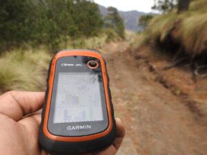
A hiking GPS device is a helpful tool that you can use to determine your location in the wilderness using Global Positioning System (GPS) technology. These personal locator devices are designed for outdoor enthusiasts who want to track their location, mark waypoints, plan routes, and share their trip details with others. Some of the features of hiking GPS trackers include topographic maps, a digital compass, barometric altimeters. All this combined with a rugged design that is built to withstand the harsh conditions of any outdoor activity.
10 Awesome Features Of Hiking GPS Devices
- GPS and GLONASS receiver: This feature allows the device to receive signals from both the Global Positioning System and the Russian Global Navigation Satellite System (GLONASS). This provides more accurate and reliable location tracking.
- Topographic maps: Many GPS trackers for hiking come preloaded with detailed topographic maps. They display elevation data, landforms, and other important information for hikers.
- Altimeter and barometer: These sensors measure altitude and atmospheric pressure, respectively. This provides hikers with information on their current elevation and weather conditions.
- Compass: A digital compass helps hikers navigate and orient themselves in the wilderness.
- Long battery life: GPS trackers typically have long battery life, so hikers can rely on them for extended periods without needing to recharge.
- Water resistance: Many GPS locators are water-resistant, making them suitable for use in rainy or wet conditions.
- Lightweight and compact design: Outdoor GPS systems are designed to be lightweight and compact, making them easy to carry and use on the trail.
- Durable design: GPS tracking solutions for hikers and hunters are built to withstand the rigors of outdoor use. They are often rugged and durable.
- Waypoint and route tracking: This feature allows hikers to mark waypoints and create routes, making it easy to navigate back to a specific location or retrace steps.
- Satellite messaging and SOS: Some GPS trackers for hiking include satellite messaging and SOS capabilities. This allows hikers to send text messages or distress signals in case of emergency. Even the Apple has added emergency SOS messaging to iPhone 14.
Hiking GPS Tracker – Frequently Asked Questions
How Accurate Are Handheld GPS Devices?
Hiking GPS trackers are often referred to as GPS data loggers because they simply log locational data to the internal memory of the GPS receiver. These hiking GPS tracking devices are engineered with highly sensitive internal antennas, making the micro GPS trackers extremely accurate. In fact, the average hiking GPS tracker will pinpoint a location within 6 feet. This results in highly detailed route documentation. This Information can be vital, especially if you are hiking or camping alone and need help.
Please note that even the best handheld GPS devices still must adhere to basic GPS principles. Therefore, accuracy can be compromised if the hiking GPS tracker is surrounded by metal or concrete, or if the location-based device is in an urban canyon environment, cave, or rugged mountainous region. In all of those mentioned circumstances, accuracy can be compromised to unknown degrees.
What Features Should I Look For In A Handheld Hiking GPS Device?
Consider features such as a high-sensitivity receiver, built-in compass, barometric altimeter, support for both GPS and GLONASS satellite systems. Another useful feature is the ability to download and display topographic maps for offline use.
What Is The Battery Life Of A Handheld Hiking GPS Device?
The battery life of a personal GPS can vary depending on the model and usage. Some devices can last up to 16 continuous hours in GPS mode, while others may last for up to 35 hours. You can extend battery life by placing handheld GPS devices in a low-power mode.
How Do You Locate Someone With A Hiking GPS Device?
To locate someone while hiking, you can use a personal GPS tracker. These devices allow you to mark a waypoint at a specific location and then track the progress of the person you are following by monitoring their movement relative to that waypoint. Some GPS locators also have messaging and SOS features. This allows you to communicate with the person you need to locate.
Can I Send And Receive Messages With A Handheld Hiking GPS Device?
Some GPS devices for hiking, such as the Garmin InReach, have built-in satellite communication capabilities that allow users to send and receive text messages, even in remote areas where phone service is not available.
How Do You Mark A Waypoint On A Handheld Hiking GPS Device?
Setting a waypoint on a hiking handheld GPS is typically done by navigating to the location where you want to set the waypoint and then pressing a button on the device to mark the spot. You can then give the waypoint a name and save it for future reference.


[…] have modern technology. Instantly summon emergency responders to your exact location with a GPS locator. This can quickly become one of the most important survival tools you need in the […]
[…] a great driving navigation app, but it’s also great when you’re navigating off-road trails, hiking, or traveling without a vehicle. It’s unique in that it gives you much more information than the […]